Monday, June 1, 2009

A lonely isolated road

A lonely isolated road lead northwards away from the Old Wonoka ruins. Past the long forgotten graves with ornate cast iron fencing and a stone crypt. The road lay beside the former Great Northern Railway, which had once swept out to the north west to reach the plains. However, the road continued into the valley, that was covered in loose, red rocks, almost lunar-like.

Melrose to Quorn to Kanyaka to Mt Little Station
204km: 3 days


Beyond lay the Elder Range with it's great spine snaking in a giant animal-like curve before us. To our left lay a rock survey cairn, dry stacked stones carefully selected to rise several metres, constructed in the 1850s on a small hill strategically seen from an identical cairn on Rawnsley Bluff, on the edge of the distant Wilpena Pound.

Here, in this seemingly empty valley, lay fresh 4WD tracks in the mud before us. It was tough riding, dodging the numerous rocks that lay on the track and the washaways. The sound of a 4WD coming over a crest before us took us by surprise, apparently returning along it's freshly laid tracks. We chatted with the driver, discovering that having just moved to Hawker a few weeks ago, he was exploring the route this track took him. He warned us of the steep descent that was to come. We had eyed off the elevation profile for several days, knowing it would bring an end to our three day ride, a quick steep descent back to our car. We were of course, wrong. A steep descent, indeed, but quick, certainly not. Covered in the same loose rock, it was very slow going, indeed, too slow. We had to contend with the bob trailer pushing the rear wheel out as it passed over large rocks, forcing us to jump off or fall off the bike.

This was the third day of our ride. The previous night we had camped beside Kanyaka Creek, where there were large pools of water filled with recent rains, a perfect surface to reflect the deep pink and orange hues in the sky from the setting sun. After setting up camp and washing, we collected firewood so we could cook and eat fireside, as the moon rose behind us. The only thing to disturb the wonder of our sanctuary was the intermittent passing of a car or truck as it crossed the cattle grid on the nearby highway.

Early on the ride, when we first crossed this creek, we were witness to the enormity of the flood waters here on a day long past. Across the vast creek bed lay a huge, intact, steel girder from the adjacent bridge from the former Great Northern Railway. One of the three pillars had succumbed to the flooding of January, 2007, pulling down with it two of the massive girders. Only one of the girders could be seen, the other presumably carried further downstream. With a campsite a mere kilometre away, we were too tired to set off exploring for it.

Friday night we had rendezvoused at Quorn before following each other north to Hawker. On a hill overlooking Hawker we selected a roadside camping spot close to where we could finish our ride three days later. The campsite was battered by a constant cold wind, but the following morning we were rewarded with views of the imposing Elder Range nearby, with Wilpena Pound stretching across the horizon beyond it. We drove the short distance to Mt Little station to drop off a car at our ride's end point, to which we would return in three days, before heading south back to Melrose, from where we would begin our three day ride.

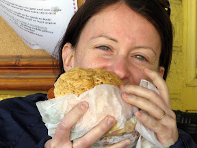
The ride from Melrose to Wilmington was uneventful, the straight flat roads quickly passing the kilometres. Sitting on the verandah of the general store at Wilmington, we ate the last two pies from the pie warmer. Beef & mushroom - I think - and a plain meat one. We had done the which-of-the-identical-paper-bags-does-this-pie-contain trick, and Nick had the fancy one. We marveled at how one small town could contain not one, but three, museums: a toy museum, puppet museum and a somewhat derelict military museum.

Perhaps the toughest part of the day, Richman Gap, lay in wait for us. It was a steep rocky 4WD track that wound its way through a pass, but beyond it was a six kilometre downhill run into Quorn. The 70 kilometre ride had been long, foreshadowing the long days that were to follow.

In Quorn, we set up camp beside Pinkerton Creek, albeit behind a two metre high security fence, in the Quorn Caravan Park. We received our eco-footprint discount, our camping fees amounting to a mere seven dollars fifty each. It should be noted though, the two of us had driven two cars up to the Flinders Ranges, leaving one at each end of our three day riding trek - it could hardly be counted as eco friendly.
After a hot shower, the cool of the evening prompted us to seek out the front bar of the Austral, one of Quorn's four pubs. Don't be mistaken though, the number of pubs doesn't so much indicate the population, but more so the long history of multiple pubs in this once busy railway town. Nick enjoyed a healthy serving of surf and turf, whilst I dug into chicken breast with chips and salad. No problem with finishing off the bread rolls or garlic bread either, clearly we had worked up quite an appetite.

Sunday we rode 66 kilometres to our Kanyaka Creek campsite, passing through Yarrah Vale Gorge Gap. From our vantage point on this winding road, we wondered upon the names of the hills that lay around us. Clearly though on the distant horizon lay Dutchmans Stern and Mt Arden. From numerous vantage points along today's ride we could see as far south as Mt Remarkable, where we had started on Friday morning, and Mt Brown, which we had passed by in Richmans Pass.

Eating lunch at Simmonston, touted as the Town That Never Was, surveyed with over 600 lots in early 1880s, along one of the nine possible routes for the Great Northern Railway. The railway was laid further east, via Hawker, dooming development of the town. All that remains today are a few stone ruins of the hotel and general store. The comparison below from Google Maps, showing the surveyed allotments on the left, and the absence of any development, on the right.


We had a seemingly endless ride across the Willochra Plain, one section at 7.5 kilometres long, slightly uphill into a headwind. After 5 kilometres or so, we sat on the road to rest from the monotony. Once riding again into the headwind, we were surprised by the sound of a car's horn behind us - a car evidently having driven up behind us on this remote road unbeknownst to either of us.

The final day was 67 kilometres, all three days were perhaps a little too far for us. Although each day had involved only some 6 hours on the road, each had left us quite exhausted, and me with increasingly sore knees. Alas, a worthwhile weekend out in the bush. I am just two to three days ride from the end of the Mawson Trail, but Graham coud not join us as this weekend as he was ill, so we will return to this area again later. I hope to spend a week out camping to complete the Mawson Trail later this year.


Stats

Mawson Trail
Friday Saturday Sunday
29/05/2009 30/05/2009 31/05/2009
Melrose to Quorn Quorn to Kanyaka Kanyaka to Mt Little Station
Distance 71.0km 64.9km 67.7km
Start Time 10.30am 9.02am 8.08am
End Time 4.17pm 4.02pm 2.16pm
Moving Duration 4h25m 4h38m 4h38m
Stationary Duration 1h21m 2h18m 1h26m
Moving Average 16.0km/h 13.9km/h 14.6km/h
Overall Average 12.3km/h 9.3km/h 11.1km/h
Oodometer 71.0km 135.8km 204.6km

Friday, April 17, 2009

Stone Hut to Melrose

A mere 52km to Melrose. Lunch at the North Star. A quick ride back to Stone Hut along the bitumen. Brrttthp.

Stone Hut to Melrose, return along bitumen road


Ah yeah, so had another Leave-Without-Pay-Day courtesy of the recession, so Graham and I decided to make the most of it and ride another day on the Mawson Trail. We would be up this way anyway for the weekend, hiking 63km along the Heysen Trail.

So the ride to Melrose was pretty cool. The lunch was fantastic. The ride back was maybe a little harder than expected, we though, from the advice we had sought from a keen cyclist, that it would be mostly downhill. It wasn't, well not until after Wirrabara, but it was still a good ride, just 2 hours back to Stone Hut.

These two photos are from Wirrabara Forest. I've heard tales of mud so thick through this forest that one couldn't ride a bike because of the mud that quickly accumulated between the wheel and frame. It seemed to be mostly dirt roads, and perhaps only a few of these seemed to hold the potential for this gripping mud. So easy to say huh?

Next 2 or 3 day ride in late May. Looking forward to it, getting back out with our bob trailers and camping.


Download kml file to view in Google Earth or adapt to use as a navigational aid in a GPS unit


Stats

Mawson Trail
Friday Friday
17/04/2009 17/04/2009
Near Stone Hut to Melrose (Mawson Trail) Melrose to near Stone Hut (via bitument road)
Distance 52.3km 39.9km
Start Time 8.02am 1.34pm
End Time 12.35pm 3.50pm
Moving Duration 3h33m 1h56m
Stationary Duration 1h02m 10m
Moving Average 14.7km/h 20.6km/h
Overall Average 11.4km/h 18.6km/h
Oodometer 52.3km 92.2km

Sunday, March 22, 2009

Introducing Wanda, Barbie and Jemima

My naming of my bike trailer, Bob, was ruled null and void by the others. The suggestion of B1, B2 and B3 collapsed with a lack of support. "Wanda," Nick said, as we passed Wanda Street in Spalding. And there it was, so the naming began.

Willalo Hall to Curnows Hut to Stone Hut
65km + 55km


Saturday was forecast for hot temperatures, but it came it cloudy in the morning after a speccie sunrise, and a cool change came in before lunch and with it a light sprinkling of refreshing rain. This was a long day, the longest yet on the trail - some 64km. The first climb of the day was from our previous ending spot at Willalo Hall up Camel Hump Range, location of the first stage of the Hallett Wind Turbine Project. Graham was blissfully unaware that he caused some bicycle-wary horses to bolt at the sight of him, jumping their paddock gate and galloping across the adjacent crop paddock into the hills. He must have been distracted by his enjoyment of the long kilometres of easy cruising at over 40km/h as we descended into the next valley.

We followed the Bundaleer Channels, which was winding but flat. The channels were constructed between 1898 and 1902, a series of channels that fed water from the local catchment area into a reservoir. There were lots of gates to contend with, and the grassey terrain made it a little harder. Other people riding this section have told of punctures and locked gates, but we encountered none of this. When I walked this section of the channels on the Heysen Trail in 2006, we also encountered a couple of fences without gates or locked gates, but this seems to have been since rectified. Apparently some riders have attempted to make the ride easier by riding along the bottom of the channel itself, although how they got into or out of the channel I don't know. As the system is no longer maintained, some sections are a little overgrown, and other sections blocked with debris or fencing. I could certainly see how at different times of the year riding along the channel pathways could be very difficult, denser grass or snake risk could be considerable.

Midway along the channels, the trail detours into Spalding. We parked our three bikes and trailers kerbside by the shop, clearly underestimating how busy a shop could get on a Saturday morning after local netball games. From here we rode further along the channels, before leaving them at one of the aquaducts the carries the channels over big creeks. Here we did put some serious deposits into the Hill Bank, from which we had very limited cashing in of on this day's ride. Near Washpool we battled with headwinds over the flat-ish track before a steep climb up Never Never Range. Even on the ridge top there seemed to be more uphill than down, and we finished the day with a mere 1.5km downhill run into Bundaleer Forest and our campsite for the night, Curnows Hut.

Sunday we continued through Bundaleer Forest, which made for beautiful albeit, slow riding. There were many gates to contend with, and the entry and exit gate from the public roads were both locked which is troublesome for our bikes with their trailers. After exiting the forest though, we got to cash in the deposits we had made in the Hill Bank, experiencing many long downhill runs towards Laura. After an identity crisis in Laura (why don't they make those pictures of men and women a little clearer on public toilets?) we rode the last distance towards Stone Hut, and our exit point from the Mawson Trail. We had left the car in Stone Hut, much to the display of the ever-friendly bakery owner, who had contacted the police in regards to the stolen and dumped car outside his bakery. Those theives though, how thoughtful of them to leave a clean and tidy, and locked, car.


Download Google Earth KML file of Mawson Trail

Download kml file to view in Google Earth or adapt to use as a navigational aid in a GPS unit:
The weekend's ride on the Mawson Trail
The Mawson Trail so far completed - Adelaide to near Stone Hut


Stats

Mawson Trail
Saturday Sunday
21/03/2009 22/03/2009
Willalo Hall to Curnows Hut Curnows Hut to Stone Hut
Distance 65.0km 55.1km
Start Time 8.27am 8.56am
End Time 5.27pm 3.51pm
Moving Duration 5h32m 3h41m
Stationary Duration 3h20m 2h55m
Moving Average 11.7km/h 14.9km/h
Overall Average 7.3km/h 8.3km/h
Max Speed 45.3km/h

Tuesday, March 17, 2009

Mt Bryan East to Willalo Hall

Continuing north along the trail near Mt Bryan East, we encountered more of that Flinders-esque landscape we had seen last ride. The view from Dares Hill Summit was rewarding, we could see for miles, although I had no real idea of what we were looking at. We left some scrub and re-entered farmland dramatically crossing Goyders Line.

Mt Bryan East to Willalo Hall
50km


Had a look-in at the the childhood home of Antartic explorer, Sir Hubert Wilkins. Cool that such an old homestead survived without even turn-of-the-century renovations, although I think it was abandoned a long time ago. I guess this is all in part due to it's isolation out there so close to Goyders Line.

Sir Hubert Wilkins was an amazing adventurer, yet unfortunately, most Australians know little of his incredible life. Sir Hubert Wilkins was born in 1888 just east of Hallett, in a humble outback cottage. His thirst for excitement and knowledge led him to enjoy a life rich with wondrous experiences. He went to the Antarctic, as a photographer and naturalist on several expeditions. 1926 saw Sir Hubert making experimental flights in the Arctic region, until 1928 when he made the first ever trans-Arctic flight from Alaska to Spitzbergen (3350km) in 205 hours. He was subsequently knighted as a result.

The Regional Council of Goyder, the Australian Geographic Society, Dick Smith, the National Trust and the volunteer based Sir Hubert Wilkins Memorial Trust Committee have restored the cottage of Sir Hubert's birthplace to its original condition.


Eating a late lunch in Hallett, thankful for the shop and lush green lawns by the local hall, we pushed on through some headwinds for Willalo Hall.


Download kml file to view in Google Earth or adapt to use as a navigational aid in a GPS unit


Stats

Mawson Trail
Mt Bryan East to Willalo Hall
Distance 51.3km
Start Time 10.01am
End Time 4.33pm
Moving Duration 3h43m
Stationary Duration 2h26m
Moving Average 13.8km/h
Overall Average 8.3km/h
Max Speed 40.0km/h

Sunday, March 15, 2009

Taking Bob out for a spin

Graham and I thought we might take our Bob trailers out for a bit of a trial run to get used to their handling.

Riverton to Auburn and return


We headed to Riverton to cover the section of Mawson Trail to Auburn. We had already been between these towns back in January, but we had gone via the Rattler Trail. This time we followed the true course of the Mawson Trail along the dirt roads, and I gotta say, it was much more interesting and scenic than the Rattler Trail, and a fair bit easier to ride.

Near Golf Course Road we came upon a locked gate. On the GPS map that I found on bikely.com the GPS track author had ridden around this locked road. The road beyond the gate was nothing more than an old road reserve and with the trail signs removed we could smell an angry landowner. So we rode around this section, taking a small short cut down the Rattler Trail. I think this just proved once and for all just how bad that rail trail really is, it is so rough, in desperate need of some finer gravel or rolling. We exited the Rattler near the famed spot where Graham had thrown his tanty last time. Later that day riding home the trail was still sign-posted in the opposite direction, so we decided we would ride the true trail. We found what appeared to be locked gates, and as we were preparing to unpack and lift our bob trailers and bikes over the gate we found the gates were not locked at all. This was also true of the gate we had first seen back on Golf Course Road! Stupid heads, should have inspected a bit closer.

In Auburn we had a yummy lunch at Cygnets, where we had eaten last time. I ordered the truly magnificent Caramelised Pear on Blue Cheese Bruschetta, my most favourite meal ever combining everything truly yummy. A few passers-by stopped to admire our Bob trailers.

There seemed to be more hills to contend with on our return ride to Riverton than we recalled going down, how easily those downhill runs are forgotten.

Overall, as expected, we were very impressed with the Bob trailers. Like pack hiking, one certainly notices the extra weight when you first set out on the trip, but you soon get used to it. Obviously due to the extra weight they still affect the performance of the bike, we had ours loaded with about 20kg of water to sumulate a normal touring weight. Nonetheless though a Bob trailer is far superior to panniers which grossly affect bike handling.


Download kml file to view in Google Earth or adapt to use as a navigational aid in a GPS unit


Stats

Mawson Trail
Sunday
15/03/2009
Riverton to Auburn Auburn to Riverton
Distance 20.5km 20.0km
Start Time 9.40am 1.10pm
End Time 12.10pm 2.58pm
Moving Duration 1h26m 1h34m
Stationary Duration 46m 13m
Moving Average 14.2km/h 12.6km/h
Overall Average 9.3km/h 11.1km/h
Max Speed 41.6km 38.7km
Oodometer 20.5km 40.5km

Sunday, February 22, 2009

The Farmer Wants a Wife

Perhaps a couple of days cycling through isolated farming and pastoral land with three guys was enough. Judith joined us for this weekend, and after a short soiree along the last 10km - all downhill - of the Riesling Trail, we left Clare and headed north-east to Burra. On an isolated dirt road, upon seeing Jude ride past, a local farmer stopped his tractor and combine harvester to jump out and "inspect his crop".

Penwortham to Burra to Mt Bryan East
2 days: 118km
Nick, Graham, Jude and myself


This didn't escape the notice of Jude, who was much impressed. He was a little older, granted, but as we rode on we wondered upon his riches and the vastness of his estate, contemplating which of the various sprawling farm homes would be his. As luck would have it, the Mawson Trail route took us straight past his house, it was clear to all that this is the house he was preparing for this new wife. Jude was in awe, it was hard not to be really. A sprawling house, almost ready to move in. Partly furnished, all it needed was a woman's touch. This was fate, there was just no doubt, the shoes the farmer left as gift were the perfect size. Also of note was the car parked in the shade under a nearby tree.

We drove up Friday night and stayed at a Heysen Hut - the old Mt Bryan East School. Nick slept in his campervan with Nicole and the kids, whilst Graham, Jude and I discussed the merits of sleeping in the building when the last comment left in the log book was from the previous weekend and commented on the appetite for human flesh the local field mice had. Well possibly it was me who was driving that conversation, but I had my mouse-proof tent handy which would ensure a sound nights sleep.

The following morning we were awoken to a windy morning with glorious sunrise colours. As we nibbled on our breakfast and played frisbee with Nick's kids, Olivia, 8 and Noah, 6, Graham busied himself wrapping his new bike in several metres of bubble wrap. Effectively protected against the hard metals of the other bikes in the trailer, we left my car at the hut and drove in the campervan down to Penwortham, just south of Clare, where we had ended our ride last month. With Graham, Nick and Nicole up front, Judith and myself discussed the finer points of an assignment which we set for Noah and Olivia. As we rode back to Burra, where they were set to spend the day with Nicole in Burra which would involve a look-in to the various op shops. The point system decided, each child selectively interpreted the list to their own liking. Noah was off to find a gun, preferably a working one, as they posed no danger, indeed, as Jude and I were sternly told, it was the bullets that were harmful. It was remiss of us though, as upon completion of their assignment the following day, it became clear to both children that we had been negligent in finding suitable rewards. Opps. Isn't the fun of it the reward?

The first day was tough, although we all took some delight in the roo racing we participated in, thankfully on a long downhill run from Camels Hump Range. So a big roo can easily bounce along at between 35-38km/h. I suggest you file that one away somewhere for it's possible use at a quiz night one day, you just never know.

Nearing Burra, we were met by Noah, Olivia and Nicole on their bikes. "Did anyone fall off?" asked Noah as we rode into town. "No," I replied. "Not even Graham?" Noah responded, clearly concerned that the bubble wrapping effort may have been in vain. Jude led the way to a apple wine place in Burra she had earlier seen advertised. We had expected to see it on the outskirts of Burra as we rode in from the southern side. As it turned out it was only about 150m from the trail, but not directly accessible from the trail, so we had to ride all the way into town, past our intended campsite on the outskirts, down to the main street, then back up a ridiculous hill the winery. And we had to do all this with the 4.30pm closing time looming. As we staggered in to the tasting area, I lingered outside for a moment to empty my water bottle over my head. Confronted with a selection of apple wines and liqueurs, each of us pleaded for a glass of water first. After a very interesting chat and the purchase of several bottles of wine and liqueur, we rode back to our campsite. We camped in an organic orchard grove on the southern outskirts of the town, belonging to a friend of Nick and Nicole. On site was some running water, a nice little caravan, and a huge stack of hay bales that provided much welcome shade in the setting sun. After a wash under the tap, we walked into town to dine at The White Cedars, the local Indonesian restaurant.

While Noah set his sights on conquering the huge plate of noodles before him, the rest of us shared our meals. It was all top food, I was particularly impressed with the gora gora (was that the name?). It was such a good meal, we forgot to take the photos of it we had planned.

To top off the fantastic meal, I think we all slept very well Saturday night. Sunday morning we were able to ride out of Burra early, a good thing given the predicted 33 degree temperature. Riding past Mokota Conservation Park we thought perhaps it more likely that this land had been donated as a conservation park rather than sought out, it looked to be nothing more than a treeless paddock atop a hill. No I lie, we could see two trees in the vast 450 hectares. Upon coming across the main entrance though, we could not have been more wrong. It was a conservation area for the native grasses, which had been extensive throughout this area prior to the devastation caused by agriculture.
It [Mokota Conservation Park] was proclaimed to protect the Lomandra multiflora ssp. dura / Lomandra effusa tussock grassland. It is one of the largest remaining examples of an open grassy vegetation community, which used to cover more than one million hectares of temperate Australia. Currently, this vegetation type covers less than 0.3% of the original extent due to clearance for agriculture.


After a lunch in the shade of some sparse but welcome trees, we climbed White Hill Road to the western extreme of the Mawson Trail. The view was amazing, and was a favourite spot of the weekend, this remote fringe pastoral land beyond Goyder's Line reminded us of the Flinders, with wide flat stony creekbeds, red rocks, winding roads and dramatic hills. After a long climb we enjoyed a long downhill ride, and Graham and Nick found a nice log to sit on under the shade of a small tree. Here after a long rest, as we rode off I glanced back to check we hadn't left anything. A handy little habit. I found myself a new camera, which I was much pleased with. Coincidentally, later on Graham discovered he lost his, so reluctantly I conceded it seemed fate was at play here and he should have this new found camera to replace his lost one.

Exiting the trail near Mt Bryan East, we rode back to the hut and car. The shade was a welcome relief, and the very cool water from the shaded water tank even better. After dissecting a few finer points of the ride, including how much further we could have ridden in the heat, we exchanged some words about team members finding other's lost possessions and then Graham re-wrapped his bike in bubble wrap for the trip home. Discussions ensued about our plans for the next weekend ride, and the special guest appearance by Ibex Bob on Saturday, which we deemed a success, may be the modus operandi of the next few rides as the campsites are fewer and far between. We certainly enjoyed the ease of our car plans this time around, last month had been a bit of a schmozzle, and it was good to not have to drive Saturday night or Sunday morning, and less driving around in general thanks in part to the car trailer.

Sitting kerbside back in Burra, we ate our ice creams, well two for Jude, not having been able to decide which might have been better. Back at the orchard we checked on how the kids had gone in their assignment. They had managed to find the Superhero book (2 points), a war item (a helicopter that had seen active service), a nine digit number (ISBN) and the biggest scorer, a pair of crutches.

Some more photos to come from Nick and Graham... Thanks for Jude for her 4 award winning photos.


Download kml file to view in Google Earth or adapt to use as a navigational aid in a GPS unit


Stats

Mawson Trail
Saturday Sunday
21/2/2009 22/2/2009
Penwortham to Burra Burra to Mt Bryan East
Distance 55.7km 52.9km
Start Time 10.43am 8.58am
End Time 5.19pm 3.18pm
Moving Duration 3h41m 3h57m
Stationary Duration 2h53m 2h22m
Moving Average 15.1km/h 13.4km/h
Overall Average 8.5km/h 8.4km/h
Max Speed 38.5km/h 40.6km/h
Oodometer 55.7km 108.6km

Sunday, January 18, 2009

Rattlin' Bones

This was our first weekend away riding the Mawson Trail and we were introduced to the Rattler Trail. Rough, very rough.

Saturday 17 January - Sunday 18 January, 2009
Tanunda to Hamilton to Penwortham, 118km


The Rattler Trail from Riverton to Auburn is not part of the main Mawson Trail, but still part of the greater Mawson Trail network. On the success of the Riesling Trail, the community of Riverton extended the trail 19km south to Riverton, but couldn't afford to lay a trail surface. So the trail is nothing more than a cleared former railway track, most of it being covered in stoney railway track ballast, although the trail was recently cleared of long grass. So it was a bone-rattling 19km. The very start of the trail near Riverton is part Mawson Trail network originally created, so soft gravel has been laid over the former railway bed. The final 500m near Auburn is also quite good, but most of the trail is very rough. The actual Mawson Trail between Riverton and Auburn follows dirt roads, maybe one day it will be shifted to follow the Rattler Trail if funding is provided to upgrade that trail to something more cycling friendly.


On Saturday we rode from Gomersal Road, Tanunda, where I finished 2 years ago, and Graham recently caught up to. On a ride a couple of months ago we finished near Tanunda, but I didn't see the need to re-do the short section between. Nick joined us today, previously he has ridden a couple of days from the end of the trail at Blinman south to Wilpena. We rode through Tanunda, Nuriootpa and Kapunda to Hamilton. We had a nice lunch at a cafe in Kapunda and chatted to some locals. The last kilometre of so of riding was off the Mawson Trail when we rode back to our car in Hamilton. Hamilton is a Nothing Town, a few houses, a former shop, telephone box and a couple of churches. We drove the short distance to Marschalls Hut - a hiking hut on the Heysen Trail - and spent the night there. The hut is on one of the loop trails out of Riverton that form part of the Mawson Trail network, but we weren't keen to ride the necessary 77km to ride all the way to the hut. We sat on the verandah, shaded by a peppertree, as the sun set over Gilbert Valley.

On Sunday we resumed back near Hamilton, riding to Riverton, where we enjoyed a morning snack and coffee in a cafe. From here we rode on the Rattler Trail, geez what a mistake that was, and once we reached Auburn we ate lunch in a very nice cafe. We could easily get used to these gourmet cafes all along the route! Alas though, I think it will only be these two days that it happens. From Auburn we followed the Riesling Trail, another former railway but upgraded to a very good trail standard, to Penwortham. The trail extends to Clare, and we rode the entire uphill bit, next time we will ride the remaining 10km - all downhill - into Clare.


Download Google Earth KML file of Mawson Trail

Download kml file to view in Google Earth or adapt to use as a navigational aid in a GPS unit:
The weekend's ride on the Mawson Trail
The Mawson Trail so far completed - Adelaide to Penwortham


Stats

Mawson Trail
Saturday Sunday
17/01/2009 18/01/2009
Tanunda to Hamilton Hamilton to Penwortham
Distance 64.1km 53.7km
Start Time 8.43am 9.46am
End Time 3.19pm 3.39pm
Moving Duration 4h11m 3h22m
Stationary Duration 2h25m 2h32m
Moving Average 15.3km/h 15.9km/h
Overall Average 9.7km/h 9.1km/h
Maximum Speed 44.5km 43.6km

Sunday, November 2, 2008

The Sunny Countryside

Despite the trials - last minute crisis of sick children and morning thunder and showers, we rode across the sunny countryside.

Day 2: Birdwood to Tanunda (take II)

Due to the uncertainty of whether we would be riding or not (sick child), we set off a little late. Despite thoughts to the otherwise, today's ride was easier than the last one and we achieved a faster average speed. Lots of sunny moments amid the warm humid day, interspersed with some cool winds. We cut the end of the ride 10km short, opting instead to ride 5km back along the main bitumen road into Tanunda.

You might remember from my last post my fat tyre, bulging and somewhat hard to ride. I replaced the tyre some time ago, and discovered that the wire inside the tyre has failed.


Download kml file.

Stats:
  • Distance: 50.1km
  • Start time: 10.37am
  • End time: 4.53pm
  • Moving duration: 3h 28m
  • Stationary duration: 2h 51m
  • Moving average: 14.5km/h
  • Overall average: 7.9km/h
  • Max speed: 47.5km/h

Monday, September 29, 2008

Fat Tyre

After a few morning set-backs with flat tyres, fat tyres and bike bars we set off on our first day's ride back on the Mawson Trail

Day 1: Athelstone to Birdwood (take II)

So 7am in a light rain, my nosy neighbour helped me fit my new bike rack properly, with the key ingredient of a few extra washers from a shed full of nuts, bolts and washers that might come in handy one day.

Graham, Pete and Sally and I met at Gorge Road and crammed two bikes onto the bike rack, and the remaining two bikes in the back of the station wagon. Bay to Birdwood traffic aside (good planning!) we drove to the start of today's ride in Birdwood. Like last time I did this section, it was decided that it would be best to do it backwards.

Stopped for lunch in Lobethal, and after a spinach and ricotta roll that was fresh, last Wednesday, and waiting for our vegie or chicken burgers to be made with all the bikies food, we tackled the steep hills after Lobethal. Lots of pushing bikes up hills, I think there was some discovering that ppl weren't quite as fit as they thought. I recall how much pushing my bike up hills I did last time with Alex, and was very happy with how I could pretty much ride up every hill now, even if I needed little breaks on the way up.

With a fat tyre, not quite sure what happened there, I ride my bike to and from work several times a week yet it's out on a trail that the tyre wall seemed to fail. A fat lumpy tyre made for some hard riding...


Stats:
  • Distance: 39.3km
  • Start time: 10.30am
  • End time: 4:45pm
  • Moving duration: 3h 5m
  • Stationary duration: 3h 5m
  • Moving average: 12.7km/h
  • Overall average: 6.4km/h
  • Max speed: 52.7km/h

Sunday, August 31, 2008

Mawson Trail Take 2

Plans are afoot to get back to riding the Mawson Trail. In late September will be riding on the Mawson Trail again, with Graham, Pete & Sally.


None of them have started it before, so we will be doing the first few days again. First up, from the start of the Mawson Trail at Gorge Road, Athelstone to Birdwood, a distance of some 39km.

We will be riding from Birdwood back to Athelstone, as that will make it a bit easier, esp for the newbies. Here's map of our planned ride (thanks to martin13):


View Larger Map

Monday, September 3, 2007

Broken foot

Further to the previous post in March about Alex's broken foot... it is now healing... but is a bit complicated so will take some time... maybe later this year or early next year we will ride again!

Monday, February 12, 2007

Broken Foot

Alex broke his foot playing soccer yesterday. Bummer for work, footy, driving and our Mawson Trail plan. At least he was doing something normal, not like my friend Andrew who also recently broke his foot. He did some pruning of a tree, climbing onto his roof. In his true unco style he stepped onto an imaginary horizontal plane level with his roof. It didn't support his weight (surprisingly).

We haven't ridden this year yet, a combo of weather and camping trips. But it looked hopeful soon... not for 6-9 weeks now...

Saturday, December 30, 2006

Day 3 :: "I love the wind"

"I love the wind"... as we reminded Heidi last night, her famous public speaking quote. That said, she would have loved today. Thunder and stormy wind overnight, so a very windy day today. Plenty hard enough getting up some of those hills anyway, sometimes the wind made it impossible.

We rode only 32km today, half what we rode last time, from Mount Crawford to Tanunda in the Barossa Valley. A sensible decision, last time we were too ambitious. Today, it was difficult riding for the first 5 or 6 kms, we had previously driven along this rode and camped at the end. We both didn't like this part of the ride, it seemed like the day was going to be a miserable one, but after we had climbed for those 5 or 6km, we rode along a ridge and experienced much easier riding, both downhill and uphill.

After being rewarded with tremendous views of the Barossa Valley at Trail Hill, we rode through the elaborate entrance to Steingarten and followed the nice roadway along the rocky ridge, through the vines, stone walls and timber viewing platforms of the Steingarten vineyard (Steingarten translates as Garden of Stones).The rough dirt road (read stony rutted road) prevented a rapid descent to the valley floor, although we still acheived speeds of about 30km/h. Riding through the rolling farmlands towards Tanunda, we detoured slightly from the trail so we could ride under the famous archway over the road at the entrance to Tanunda.

We rewarded our day's ride with a late lunch at a Tanunda bakery, making it in just before they closed. The shorter ride was much better, both mentally and physically. The predicted afternoon thunder never came, instead the wind dropped and the skies cleared.

    Stats:
  • Riding: 32.2 km
  • Riding Time: 02:06 hrs
  • Rest + Riding Time: 03:25 hrs
  • Average speed: 15.3 km/h
  • Max speed: 50.4 km/h
  • Temp: 30 degrees (Adelaide 33), windy, sunny

Saturday, December 16, 2006

Day 2 :: Butterflies

Ever had that feeling of butterflies before you start something big? No, I didn't mean those butterflies. I meant butterflies, the winged variety. We saw so many as we rode today. Alex even tasted one, not voluntarily, but he said it was a much better experience than having a fly in your mouth. Apparently they feel like paper.

Anyway, did the Montacute (the bridge we finished at last time) to Mt Crawford section today. We decided to ride this section of trail from Mt Crawford (450m above sea level) down to Montacute (125m above sea level). The highest we got was near Cudlee Creek (577m above sea level), just prior to the steep descent back onto the Adelaide Plains. It was a rapid descent, mostly on rough dirt fire tracks, so it was braking intensive; it's quite difficult to go above about 30km/h on the rough track littered with rocks and branches.

We left my car in a car park adjacent Linear Park in Athelstone, and drove Alex's new van up to Mt Crawford Forest. Riding through the forest was cool, although much of the trail was surprisingly sandy, as this photo of Alex can testify. It was a little unnerving riding beyond Glen Davon Road in the forest. I like to follow closely on the map where we are, there are plenty of markers to lead cyclists, but it is much easier to follow the trail when you anticipate where it is going. Upon coming across the the bitumen of Cricks Mill Road we noticed that in the area we had just ridden, the map and the trail were quite different. I was relieved to know that my map-sense was still good.

On the ride into Birdwood, some 20km from where we started, we rode along a steep undulating bitumen road, allowing us to ride quite fast down hill. Down one of these hills, we achieved 51km/h. With the wind rushing past our ears, we didn't hear a car approach us from behind until it's driver beeped his horn, moments after passing me and just before reaching Alex. I think Alex got quite a fright! At 1pm we reached Birdwood and stopped for a snack at a little servo (after meeting at Alex's house at 9.30am, we had started cycling at 11am).

From Birdwood, we rode to Lobethal, climbing over Mount Torrens. If it were somehow possible, I would have done a little shout-out to Sue and Michele who live there somewhere (walkers in the Heysen club). The trail didn't pass over the peak of Mount Torrens, but was close! It was in our ascent here that Alex rested on the road, his back was giving him some grief.

By 3pm we reached Lobethal, where we ate lunch, perhaps the food at Birdwood was our 'elevensees'? I had worked up a bit of an appetite by now, so the chicken ceaser baguette with avocado hit the spot. We topped up with water at the public toilets behind a hall. I had finished my 3 litres of water from my bladder, and I think most of it had been transferred through my other bladder... sorry, I couldn't help that stupid play on words, I had finished the 3 litres of my hydro pack. It wasn't an overly warm day, but noticeably cooler on the shady roads of Mount Crawford.

At Lobethal, we psyched ourselves up for the ride up to the highest point of today's ride. We were now quite comfortable dismounting from our bikes and pushing them up steep hills. Earlier in the day, it was asthma that got me walking my bike up hills, but now, the moment Alex got off his bike ahead of me, I was off too. Fatigue was taking it's toll on us. Now I know why when you see promotional photos of the Mawson Trail, there seems to be so many photos of cyclists lying down in the grass besides their discarded bikes. It seems to be how one spends a break when you just ride up one hill after another. Cudlee Creek gave us no such grass, and besides, it was summer, I think grass is more likely to invite snakes. We lay on the dirt in the shade of a shelter, marking the first entry point to the Cudlee Creek mountain bike loop network. After psyching ourselves to climb the remaining 40 metres to the summit of today's ride, we rode through some of the loop network. We didn't really need to, it added a couple of kms and the trail only returned to the dirt road a few hundred metres on from where we had left it, but it was cool to ride through. It's plantation forest, with many fire tracks winding through it, offering glimpses through the hills towards the Adelaide plains and Outer Harbor. We then rode through some vineyards, and began our descent back down to the Adelaide plains. It was on these dirt roads that I first noticed my slowly deflating rear tyre. The tyres had slime (fyi for you non-cyclists: it's a fluorescent green liquid placed inside the tyre tube that seals small punctures) in them and rubber stripping, but the slime in my rear tyre was numerous years old. We topped up the tyre with a CO2 canister, but by the time we reached the bitumen of Gorge Road it was tough riding. I stopped at the bridge where we ended last time, and Alex rode on another 1.5kms to where the car was parked. We only had one other technical problem, again with my bike. Back a few kms before reaching Lobethal, my rear derailleur came off from it's fixing point to the frame. Luckily I could find the missing screw on the road, and it was quickly established it was just a case of it being vibrated free on the corrugated dirt roads (you may well think it was loose before we even started riding today... but I won't think that cos it makes me look bad). In those vibrations we also lost my tyre pump - mental note: when I buy a replacement select one which is fastened on securely, not held on my a pressure clasp.

We drove back to Alex's van, camping roadside overnight. We would have camped at a campsite within Mt Crawford forest, but camping is not allowed in December (or January to March), so we camped outside the forest on the side of a dirt road. We cooked up a nice meal of chilli sausages, rissoles and mashed potatoes - and beer - and experienced the stillness of the sunset. We slept in the back of the van. The next morning we met a local whose house was close by, an old dutch woman. She was very gracious in offering us hospitality, but we had decided that morning not to ride from Mt Crawford to Tanunda, a distance of some 35kms, but instead return home for a day of rest; we were very tired and stiff from the previous day's ride. But it was touching to have the invite, I think the previous night we expected the opposite reaction, as in "move on" or "why are you using a gas cooker - can't you see all the dry grass everywhere?". It was a little funny deciding not to ride to Tanunda, it was like neither of us wanted to make that call, but both of us were relieved once one said perhaps we shouldn't ride! I think in retrospect the ride was a little too ambitious for our current fitness levels, we didn't have much left in us by Lobethal.

    Stats:
  • Riding: 60.5 km
  • Riding Time: 03:55 hrs
  • Rest + Riding Time: approx 7 hrs (did we rest that much?)
  • Average speed: 15.4 km/h
  • Max speed: 55.8 km/h
  • Temp: 22 degrees (Adelaide 25), sunny
As an erratum to this blog entry, I've added a Google Earth file showing where we rode. I did this at work today, it's the Friday of the week between Christmas and New Years. Of my team of 7, I am the only one here, and I have nothing to do. I think I'm just about finished for the week (it's 11am). Anyway, so I loaded the Heysen Trail GPS data on Google Earth, very interesting, for inclusion on the new website I am making for the walking club. Then today I thought I might have a play around to load a bit of stuff on for the Mawson Trail ride we did. However, with no GPS data, it's just a series of placemarks, rather than a continuous line with added placemarks, so perhaps you have to play the placemarks to get a better idea of where we rode. I'm not sure if I would bother to do it for any other rides, it's not like I am normally this bored anywhere... I wouldn't mind a camera with GPS so a trail line can be loaded on Google Earth, and photos viewed where they were taken. That could be very cool. Yeah, so, the Google Earth file to download and view.

Sunday, December 3, 2006

Day 1 :: Negative Gearing

It just didn't feel right to start the Mawson Trail at the bridge where Gorge Road entered the gorge (at Montacute, just past Athelstone). It just seemed such an insignificant spot. So we decided to start our trail at the beach, where better? The Mawson Trail: 800kms from the beach at Adelaide to Blinman in the Flinders Ranges. Much better than The Mawson Trail: 800kms from an obscure weir in a gorge near at Adelaide to Blinman in the Flinders Ranges. Just doesn't work, does it? Nope. So we started not at the zero point of the trail, but at the minus 34km point: West Beach.

There were a few logistics to solve. One, as Julie kindly pointed the irony out to me, Alex, who offered to ride with me, didn't have a bike. Thanks to Tim for the borrow of a super light bike. Yes, I can really feel Kate's angst now, that her husband's bike is so ridiculously lighter than any other bike. That must be why, at the end of the day, having ridden 45km, I was struggling to make it back to Alex's house, and Alex, well, not so, he had to keep waiting for me. His bike was lighter. That had to have some effect.

We left a car at the railway station by the Entertainment Centre and caught the train to Grange. From there, we battled head winds to ride the 5kms along the beach esplanades to where the Torrens River meets the sea. The wind was tough - had some second thoughts about this whole ride-the-Mawson-Trail idea, riding seemed so much harder then I remembered. But seeing the number of people flying huge kites and kite-surfing at Henley was comforting, yes, the wind was strong today. I wonder where we will be riding next time we experience winds that strong...

We stopped to take our official start photo, then rode the relatively easy ride along the River Torrens Linear Park (no wind here!). We rode quick, passing many people, although one guy got the better of us. We rode the 34kms to where Linear Park enters the gorge of Gorge Road, where the trail peters out to nothing, stopping at the water pipe bridge. I didn't have the official Mawson Trail maps yet, BicycleSA had sold out of map 1, but I was told the trail officially started on the other side of this bridge, although it actually started several hundred metres further upstream at a weir, which might be why we couldn't find any signs.

I enjoyed riding along the Linear Park trail, always a nice ride. Good to ride through Athelstone, past one of my cool places, that really old homestead surrounded by a stone colonnade and stone walled yards, old machinery and old stone sheds. I love it, it is just so cool. Sorry, no photos, didn't stop to take any. We only stopped for two rests, plus one at either end of the trail.

Rode back down Gorge Road about 7km to Alex's house. Alex's butt was sore. He hadn't ridden a bike for a long time (hence the owning no bike!). The next ride? When the weather and our social calenders line up...

    Stats:
  • Trail riding: 34 km
  • Total riding: 47.3 km
  • Riding Time: 02:26 hrs
  • Average speed: 19.3 km/h
  • Max speed: 43.5 km/h
  • Temp: 22 degrees, sunny

Monday, September 25, 2006

The Mawson Trail

So I've been keen to start riding the trail for a while now. Ideas have developed over the past few months, and I think I'm going to be able to start answering it's beckoning call soon...

Map of the Mawson Trail


This map is sourced from the www.bikely.com website.